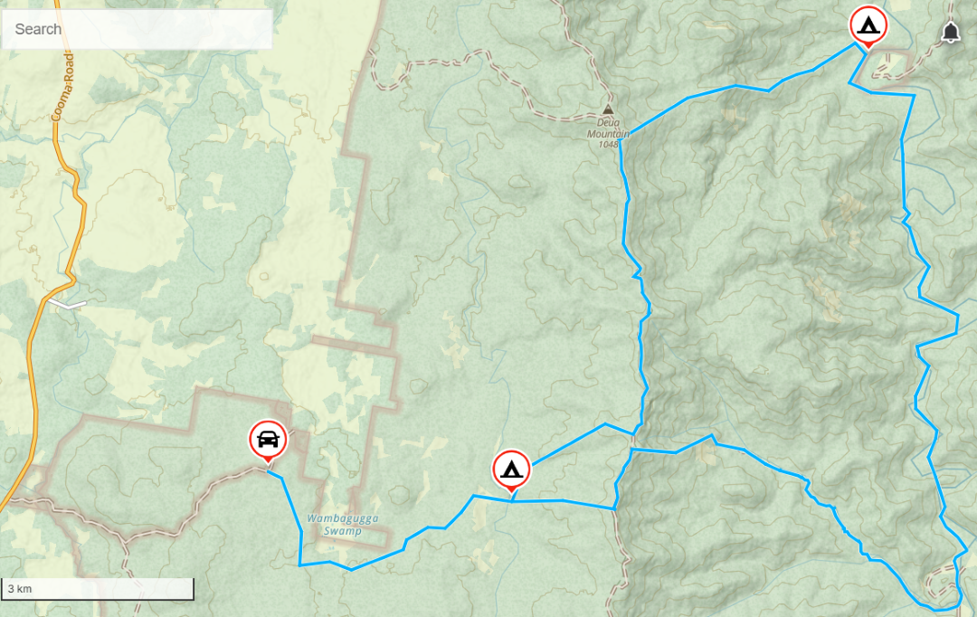
Situated in SE NSW, the headwaters of the Shoalhaven and Deua rivers offer wilderness walking of medium to hard difficulty, for trips of up to four to five days duration depending on the ridge chosen to exit from the Deua Valley. Walk in this area enable a party to explore sections of the Shoalhaven River above the Great Escarpment and the Deua River below it, while mostly walking through wilderness. Any trip taking in both rivers requires ascents and descents of up to 700m partly through regrowth scrub following the intense 2019-2020 wildfire. Fortunately both riparian environments have largely escaped fire damage.
Apart from the extensive Bendethera car camping area, walking is through wilderness. A western Deua wilderness was identified on 21 December 2000 and extends north from the top of Mt Snowball essentially follows the western boundary of the Deua National Park and the Minuma Range. East of that range, most of the Deua National Park was identified as wilderness in 1991. The Deua Valley never became a declared wilderness.
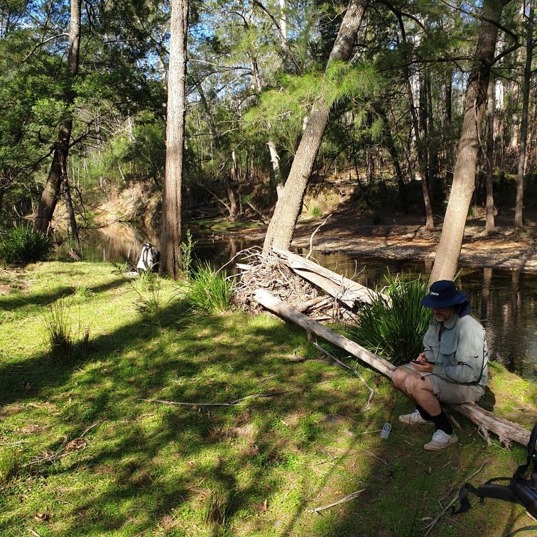
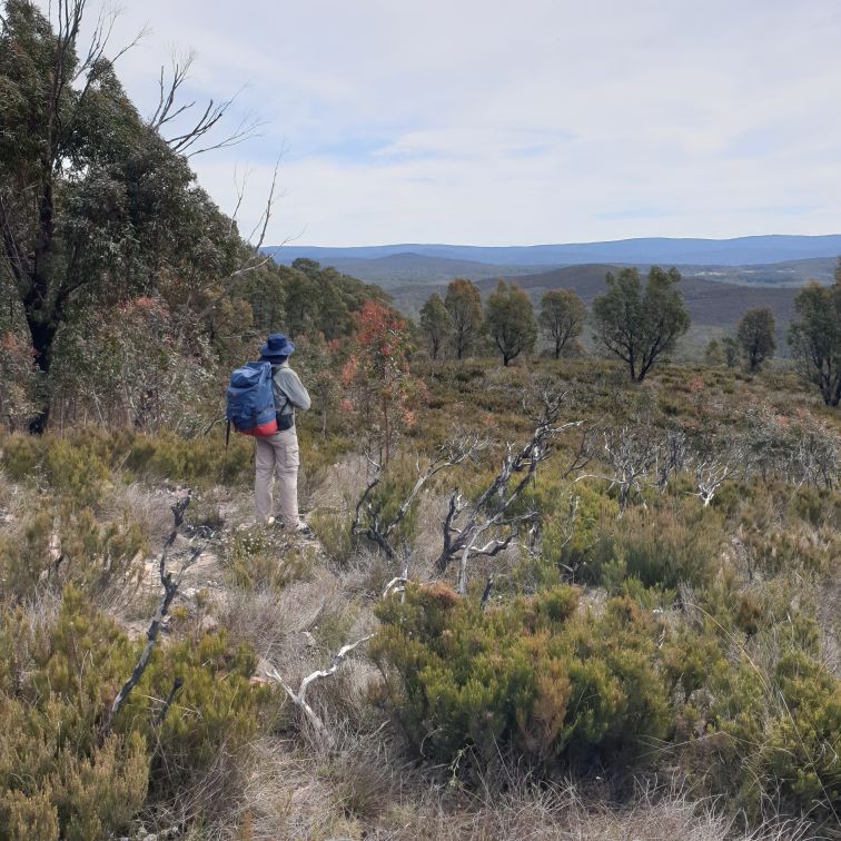
Martin Pfile and I headed down for a three full day two half day adventure on 19 October 2024. The trip notes below are provided in some detail, as this diverse and scenic wilderness deserves more visibility.
Getting there: The walk’s start point is reached by way of Braidwood, three hours from Sydney. Braidwood has plenty of good lunch venues and places to stay if you are driving down on Friday night or planning to come back late after your trip.
The start point is an hour south of Braidwood via the Cooma Road-Krawaree Road (Main Road 270) that leads up the upper Shoalhaven River valley. About 69km from Braidwood, after fording Snowball Creek, look for the Middle Mountain Road turnoff on the left after the rise about 300m past the ford.
Veer right off Middle Mountain Road onto Currambene Road 2km from the Cooma Road turnoff and drive east another 2.4km to find a suitable parking spot (about GR 371 204 Snowball) around kilometre before the national park boundary. Apart from the rocky Currambene Creek ford, Middle Mountain and Currambene roads are 2WD suitable. In case of high creek levels, insufficient vehicle to road clearance to cross the ford or tree falls be prepared for a longer walk. It is handy to carry a bush saw in the car to get your vehicle out of difficulty if tree limb blocks your way.
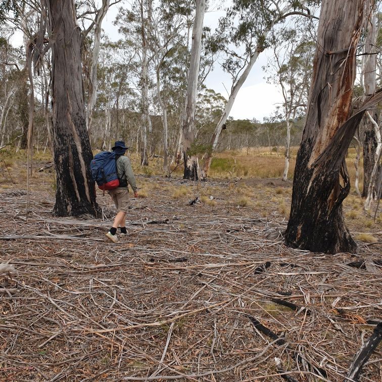
The walk – avoid private land by walking SSE from the car down a shallow spur to a feeder creek into Wambagugga Swamp off Middle Mountain. Keep to the dry ground above the treeline that marks the edge of the swamp and work your way east around the swamp crossing portion 4, Parish of Shoalhaven, that is now in the national park. Head generally east and slightly north to a saddle (GR 402 199 Snowball) and cross over to the Shoalhaven River to collect water. This is the last water till lunch on Con Creek, so fill up for the morning. On the base of the Minuma Range ascent spur, about 5.5km from the carpark location on Currambene Road, you should find a good campsite.
If you have plenty of time, an alternative camp site is located north from the GR 402 199 saddle and found by following the true right bank of creek that flows out Wambagugga Swamp for two kilometres downstream. Cross this creek and pass over a low spur to drop down onto an incised river bend to camp beside some nice pools .
Ascending Minuma Range the next day you soon discover dense fire regrowth that rules out using the traditional more gradual descent by the 4km long Con Ridge to the Deua Valley. Instead, carefully descend the direct, somewhat tricky and the steep spur above Bendethera Caves (at GR 427 206 Snowball) from the Minuma Range Fire Road. About two thirds of the way down this spur to the valley, the walking track to the Caves Track can be accessed. This well-used track is located in a gully to the south of the limestone outcrop on the descent spur. Leave packs by the track and visit the publicly accessible Cave at the top of the track. From Con Creek and downstream to the southern end of the extensive Bendethera car camping area is easy walking.
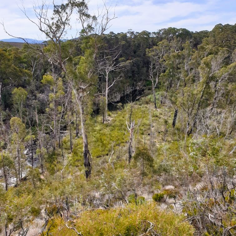
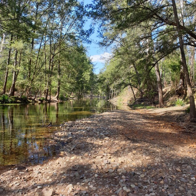
There is no sign of a track along the Deua River to the Canoolie private inholding located about 13 river kilometres downstream of Bendethera, although a cairn on this track, allegedly marking Aboriginal graves, can be located at the top of a spur above the river. Walking down Deua River is enjoyable and straightforward. If an early start is made on the Shoalhaven, a party should be able to travel down Con Creek and the Deua River below Bendethera to reach a suitable river campsite by evening.
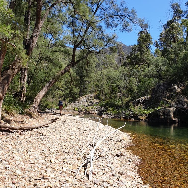
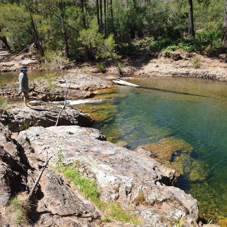
Enjoy the river and various swimming holes the next day as this is the highlight of the trip. We walked downsteam and around the Canoolie property to camp in the national park on the true left side of the river below the most direct exit ridge (GR 466 266 Krawarree). Given dense fire regrowth, we chose this 4km exit spur, climbing south west and then through regrowth scrub west to reach the Minuma Range Fire Road before lunch.
Alternatively, continue past the Canoolie property for another days walking by the river. Choose the obvious exit spur two river kilometres upstream of the Alpine property (GR 457 284 Krawarree). This downstream reach contains clearings and a 4WD track. This later exit requires a 5km longer road bash along the Minuma Range Fire Road to appropriate descent spurs to the Shoalhaven River.
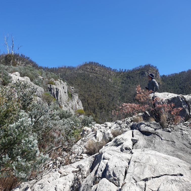
Before the departure point from the Minuma Range Fire Road (GR 427 208 Snowball), a vantagepoint on the left can provide lunchtime views over the Deua Valley. Turn off the road 200m from the vantage point to spot height (1026m). For there you can either descend south east to the Shoalhaven or follow a north east spur to camp of a river flat below an incised river bend (GR 406 220 Snowball). There are also plenty of camp sites along the creek that flows out of Wambagugga Swamp. From there it’s an easy morning’s walk to the cars.