It was around May 1st 2024 when Hughie the weather god, with predictions of heavy rain from the Bureau of Meteorology (BoM), cancelled our 4-day Deua and Shoalhaven River adventure. My follow travelers had booked leave with the powers that be, so I had to come up with a Plan B or become that dreaded specie of piker, one that cajoles friends into taking holidays, then abandons them to the obligations that arise from taking holidays and staying at home. So it was now a case of trip planning by BoM, or entering the Deua walk in Wild’s Fiasco stories challenge.
Fortuitously, BoM identified a good option, when all seemed gloom and wet raincoats. South of Canberra, on the ACT-NSW border, had a reasonable prediction. The rainfall estimates there were a bit all over the place, but Namadgi National Park looked ten times better than the anywhere else in central and eastern NSW. It looked like the trip was ON...
Getting there
There’s nothing like the beginning of a bushwalk for getting your hopes up. Every kilometre south from Sydney meant less cloud and by the time we reached Canberra we were all feeling pretty chipper.
Bimberi wilderness(1) in Namadgi National Park(2) is five hours from Sydney. Take the Canberra bypass to the Monaro Highway, then take a right turn to Tharwa Drive and the Nass Road.
We reached Namadgi National Park visitors centre around noon and spread out our maps on a picnic table. The main landscape features of the Scabby Range region were soon found - the Boboyan Valley, Sams Creek, Mts Kelly and Gudgenby, and the Scabby Range, and oh its Yankee Hat, not Scouts Hat. Somewhat orientated and in weak sunshine we headed down the Boboyan Road to a track head in the Gudgenby Bush Regeneration Area(3) with a vague aim of reaching Mt Gudgenby (1739m) and working it out from there.
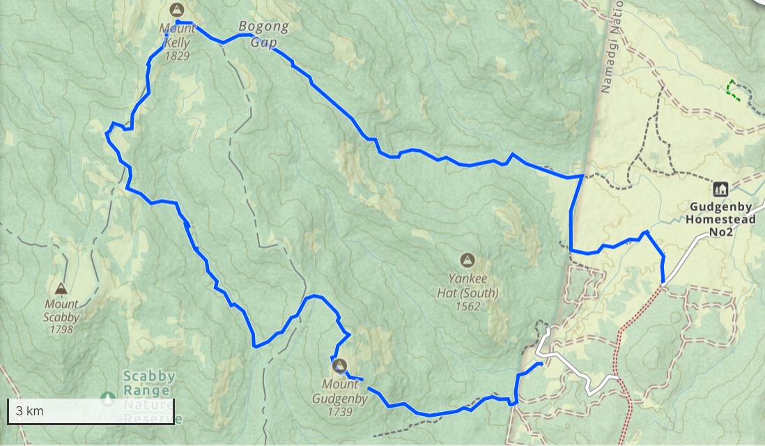
The walk
Soon we're following Bogong Creek upstream through the former Boboyan pine plantation(3), then toward a saddle, a high camp, and so in BoM we trust... Sometime after 5pm, two thirds up Gudgenby and amongst thick regrowth, it was a case of getting torches out to reach the summit or camp.
Enmoore had ideas regarding a slopy granite slab, that became our paradise for the night, no problem with sleeps here, too tired to care.
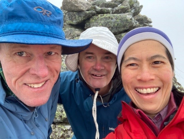
Next morning we’re “socked in.” Reaching Gudgenby’s giant summit carne didn’t pose much of a problem and the weather was on the improve, but the post-fire scrub was average. Then with the usual bumbling we reached Sams Creek sometime after lunch and began thinking, where to now?
A few kilometres upstream was a direct spur leading to Scabby Range Tarn. It looked like a nice destination. The last time I travelled in these parts was with photographic legend, Henry Gold. Back then (20 years ago?) we sauntered along a faint 4WD track to the foot of Mt Kelly. You never trust roads for navigation. My recollections provided amusement as this 4WD track had, thankfully, disappeared.
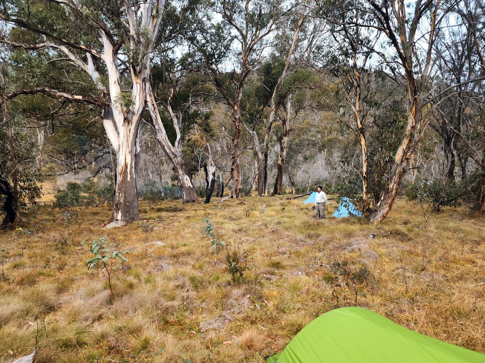
Around 4pm a nice camp appeared, and being nice, it invited us to stay. The arboreal possums or gliders squeaked hello during the night but didn’t show themselves. A lovely copse of old growth gums(4) on a gentle rise above Sams Creek framed our camp, and a fallen log made for a back rest. Not a feral horse was seen. You had to look hard to find weeds. It reminded me of how the Pilot wilderness was before the horses took over.
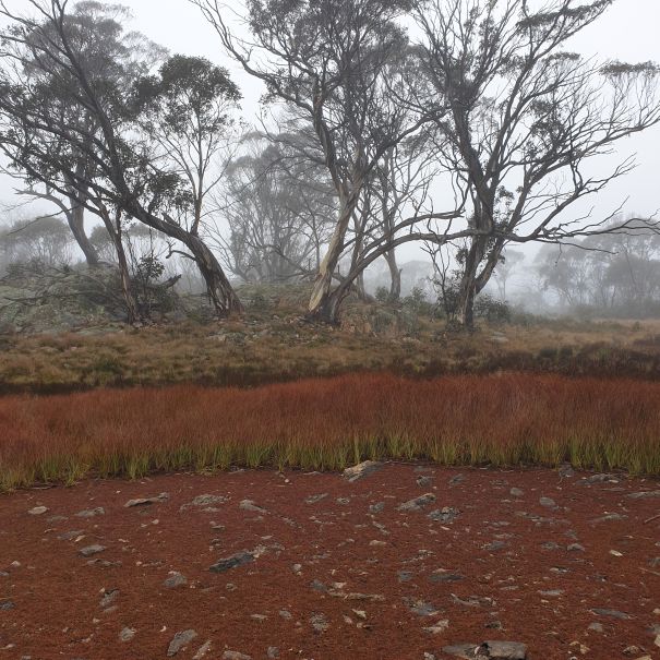
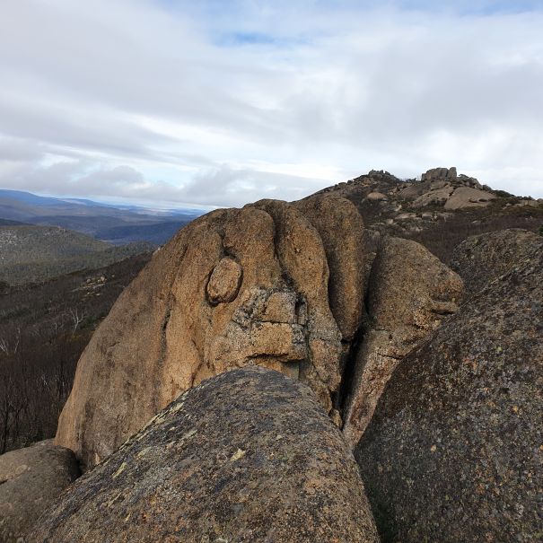
Scabby tarn was easily reached by morning tea the next day. A surprising nationally significant wetland, with very little water. Its beauty was the highlight of the trip. The misty weather suited its subalpine character(5). We walked round it, then headed toward Mt Kelly.
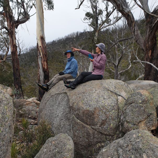
The tops of the range were easy travelling. From the Boboyan Valley track head, the western half of Scabby Range would make an enjoyable three or four day traverse, but in a few years scrub regrowth might make travel difficult.
Mt Kelly (1829m) was reached just after lunch but Rotten Swamp, another nationally significant wetland, was a bit too out of our way, but maybe next time, as from Kelly it looked a lot better than it sounds.
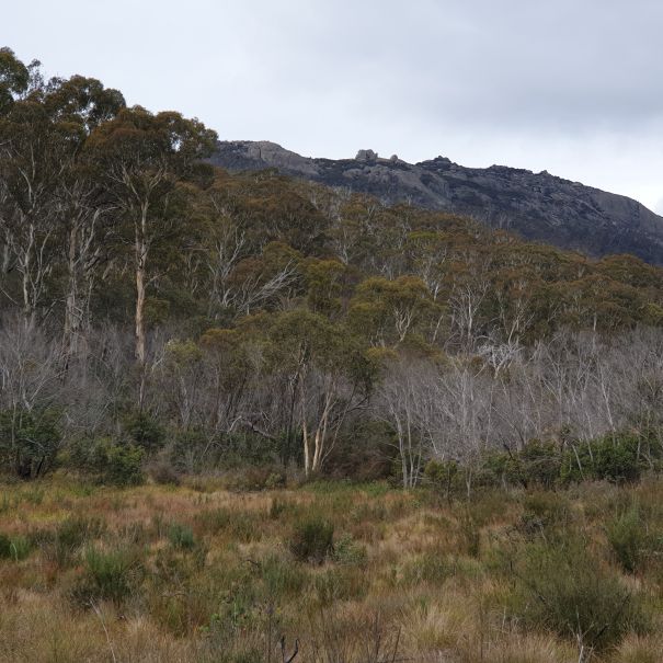
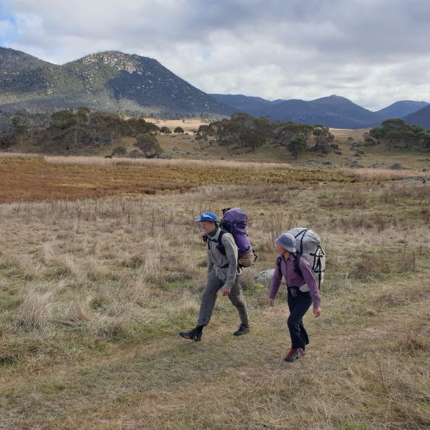
Somewhat reluctantly we headed down to Bogong Gap and then a frost hollow clearing high on Middle Creek for another comfortable camp till light drizzle sent us into our tents. Next morning the sun popped out making for a lovely descent past granite boulders and Yankee Hat till eventually we reached the cleared lands around the former Gudgenby homestead. Then it was a race along tracks to the car, then lunch and home.
Sharing driving made car travel safer and more relaxing, and we made back to our respective homes by dinnertime no trouble at all. Compared to what the weather could have been like, it was pleasant, as cloud cover had kept us warmer than we might have been otherwise. We’d found a hole in the weather doughnut thanks to BoM, and by being flexible and adaptive had a great trip.
Endnotes
- Bimberi Wilderness is 61,800ha in size, with 28,900ha in Namadgi National Park in the ACT and the reminder in Kosciuszko National Park and the Scabby Range and Bimbery Nature Reserves in NSW. Bimberi Wilderness is one of three wilderness areas spanning the northern end of Kosciuszko National Park.
- Management of Namadgi National Park has not surrendered to the demands of the off-road vehicles and horse lobbies. In this ACT half of the wilderness, effective pest species programs protect Canberra’s drinking water supplies. Unlike Sydney’s water supply catchment in the southern Blue Mountains, there are few feral horses, little pig damage or weeds. And compared to madness of Kosciusko National Park’s hydro-industrialisation, ski resorts, horses and roads, Namadgi is a sanctuary.
- From 1997 to 2005 the Gudgenby Bush Regeneration Group has removed all the pine trees and restored the native vegetation in the 380ha Boboyan pine plantation in the southern part of the park.
- The woodlands of the foothills on Namadgi National park (<1,400m) are a rich mixture of Snow Gum, Mountain Gum, Narrow Leaf Peppermint, Alpine ash and Manna Gum with an understorey of pea shrubs and Poa grass species.
- The tops of Scabby Range (>1,700m) have sub-alpine vegetation. A characteristic Snow gum-Black sally eucalypt association surrounds frost hollows with small areas of bog, fen, heath and sod tussock grassland that dissect these woodlands.