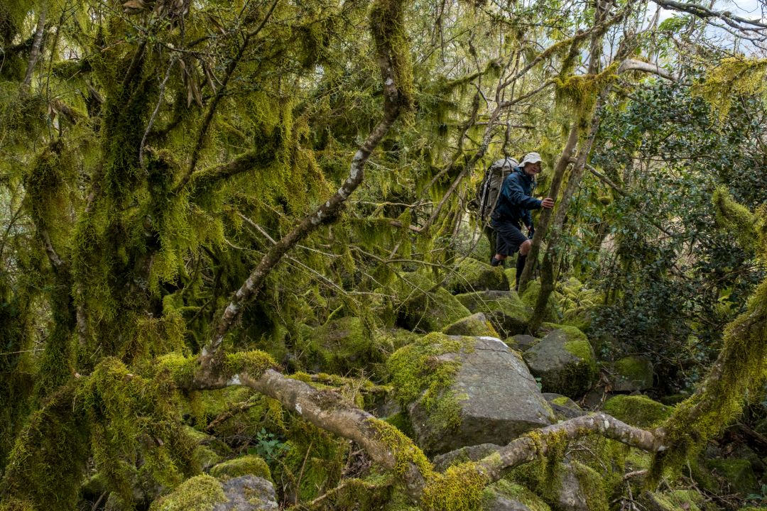
From 11 to 15 September 2024 Ian Brown and I tackled a three full day, two half day rollocking circuit of the Mt Royal Range. Starting at Youngs Trail trackhead we descended 500m to Boonabilla Creek and went upstream to Blue Gum Flat. Then, after pushing through the initial thick tangle of scrub and vines climbed steeply to Cockcrow Mountain (1398m), then down the rolling rocky range to Mt Royal (1184m) back to the trackhead. This trip requires negotiation of rock jumbles that some might find challenging, although once you're on the range there is not too much elevation to negotiate. The warning about stinging trees on Boonabilla Creek should be taken seriously.
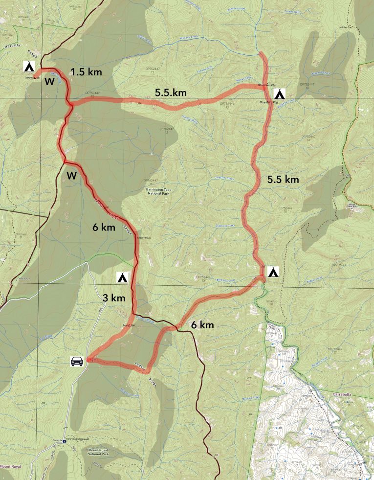
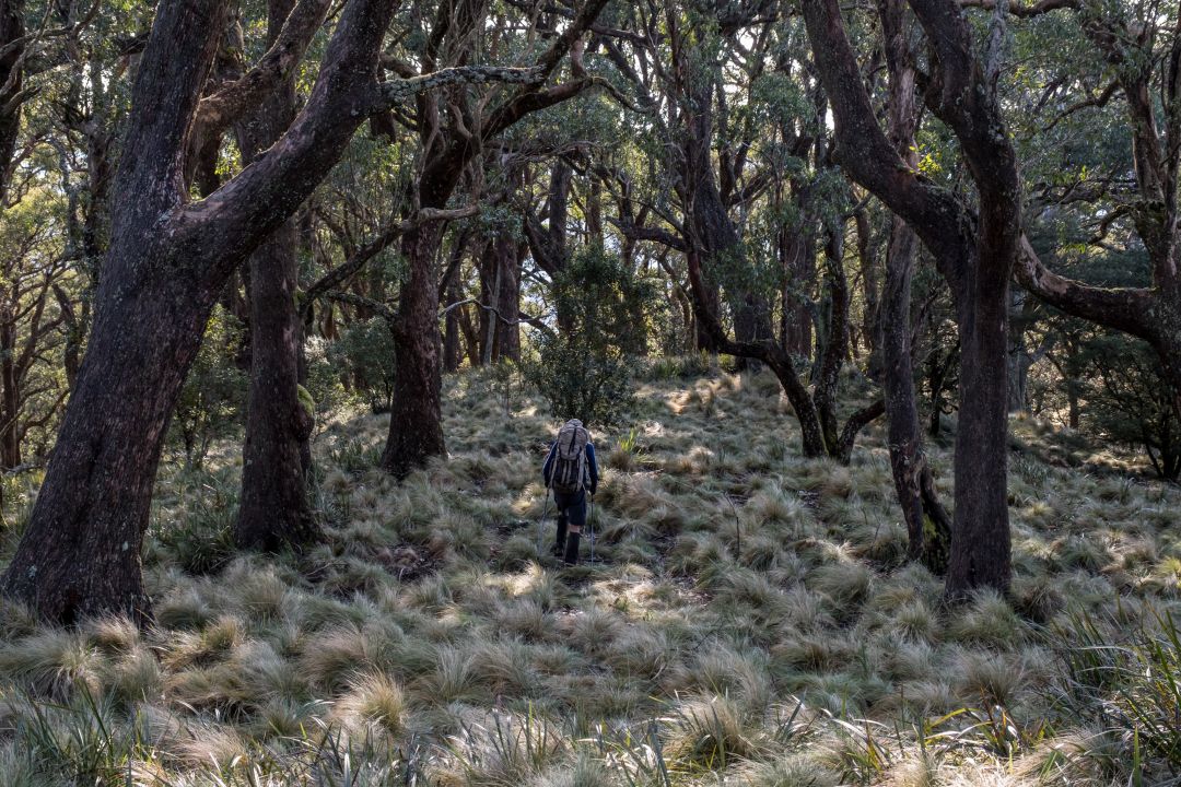
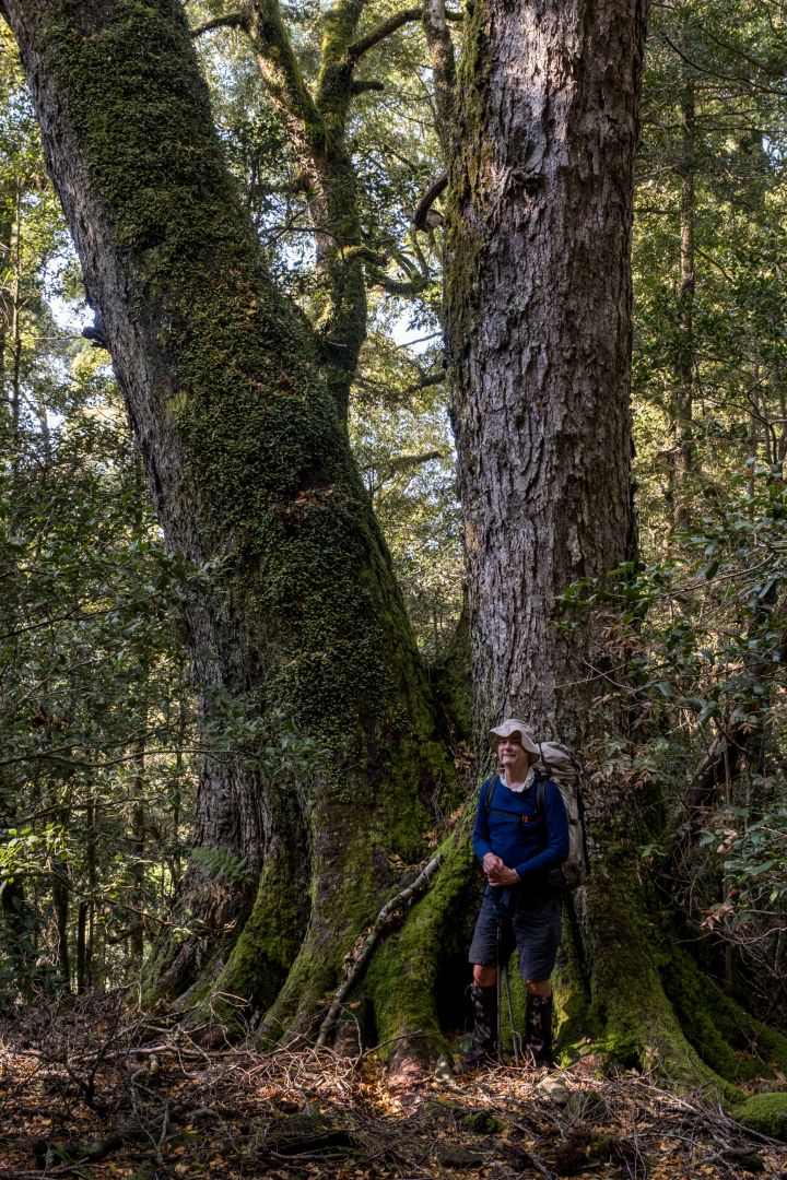
Spectacular Mt Royal Range defines the south-western end of the 58,688ha Barrington Wilderness, and is part of the Gondwana Rainforests World Heritage Area. The range includes large areas of warm temperate rainforests, stunning cool temperate rainforest of Antarctic beech and extensive tracks of grassy eucalypt forest that are divine walking.
Getting there is up to a four hour drive from Sydney. Take either the Putty Road or the M1 and New England Highway to Singleton then head north on the Bridgman Road that becomes the Carrowbrook Road. Turn left at Carrowbrook to the Mt Royal Road and at the end of the road to arrive at the Youngs Trackhead. Simple.
Accommodation The Youngville NPWS campground is conveniently located at the end of Mt Royal Road, but has only two sites that requires a $6.00 booking fee paid through the NPWS website. A better range of accommodation is offered nearby at Callicoma Hill, 529 Mt Royal Rd. Your host is that National Parks Association stalwart, Martin Fallding. The minimum fee is $200 for the bunkhouse (groups up to 10) or camping (groups up to 50), or eco-cabins for $360 (2 adults for 2 nights). Bookings are essential. Book the camp or the bunkhouse, and you get the place to yourself.
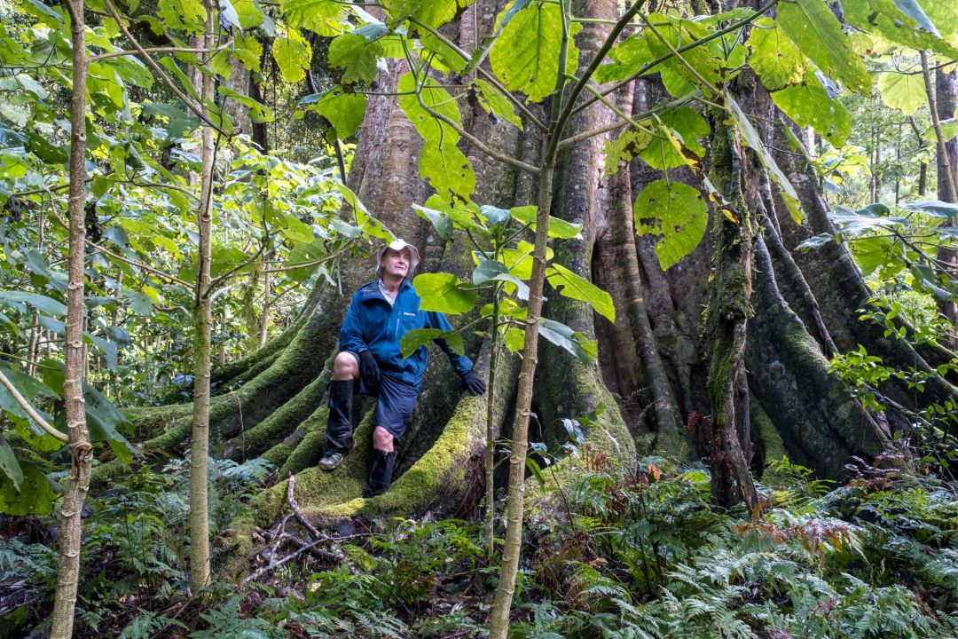
The walk On leaving Youngs Trail you enter subtropical rainforest along Boonabilla Creek. The plan of management states this creek valley “contains many examples of colonising and late successional secondary species.” Apart from an amazingly big fig tree and a bit of the creek, I didn’t much notice the Lilly Pilly, Black Apple and Whalebone trees. My mind was fully taken up avoiding the tens of thousands of Giant Stinging Tree saplings that line the valley. Blue Gum Flat was nice and the galley forest of River Oaks were draped in spectacularly flowering orchids. The stinging tree saplings, however, with so many leaves at body height mean walking the creek is a Day of the Triffids owwie minefield. In a few years this valley may sort itself out but till then, watch out!
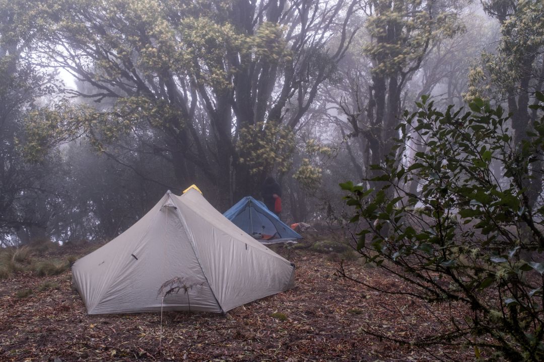
There’s no trouble finding campsites along the Mt Royal Range from Cockcrow Mountain south to the Youngs trackhead. Reliable water is available just off the range in the headwaters of Fal Brook and Davis Creek.
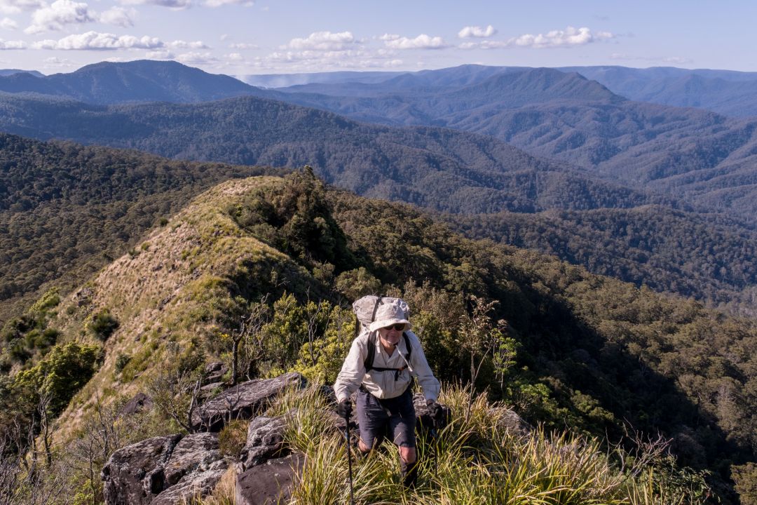
The views from Mt Royal extend south to Mt Yengo, seen just a few points to the west of the steam rising from the cooling towers of the Liddell and Bayswater power plants. Various points on the northern end of this mountain give views of the Barrington Plateau and Mt Carrow to the east. Cockcrow Mountain offers a better view of the Liverpool Ranges in the north-west, but the main attraction along this dramatic range are its wonderful old growth forests.
Check out the album for some of Ian Brown’s best photographic work.
A non-wilderness but pleasant alternative circuit is be achieved by diverting left from the shelter shed at Youngs Road trackhead to Cassels Road and walking five kilometres on that road before steeply climbing 250m to Fal Pinnacle for a dry camp on the edge of the wilderness. From there you can climb north to Cockcrow Mtn to camp and then continue south to Mt Royal. A shorter option, which can be done as a day walk, is to traverse Mt Royal to Sneaky Pinch were an overgrown road descends to Cassels Road.
Another less nerve-wracking overnight wilderness walk from the Youngs trailhead with plenty of elevation, is to take Youngs trail to Boonabilla Creek, but follow Youngs trail downstream for a kilometre, cross the creek and ascend 700m over five kilometres using the closed Cabre Bald trail, then cut through the bush for a dry high camp on Mt Cabre Bald. Return the same way you came.